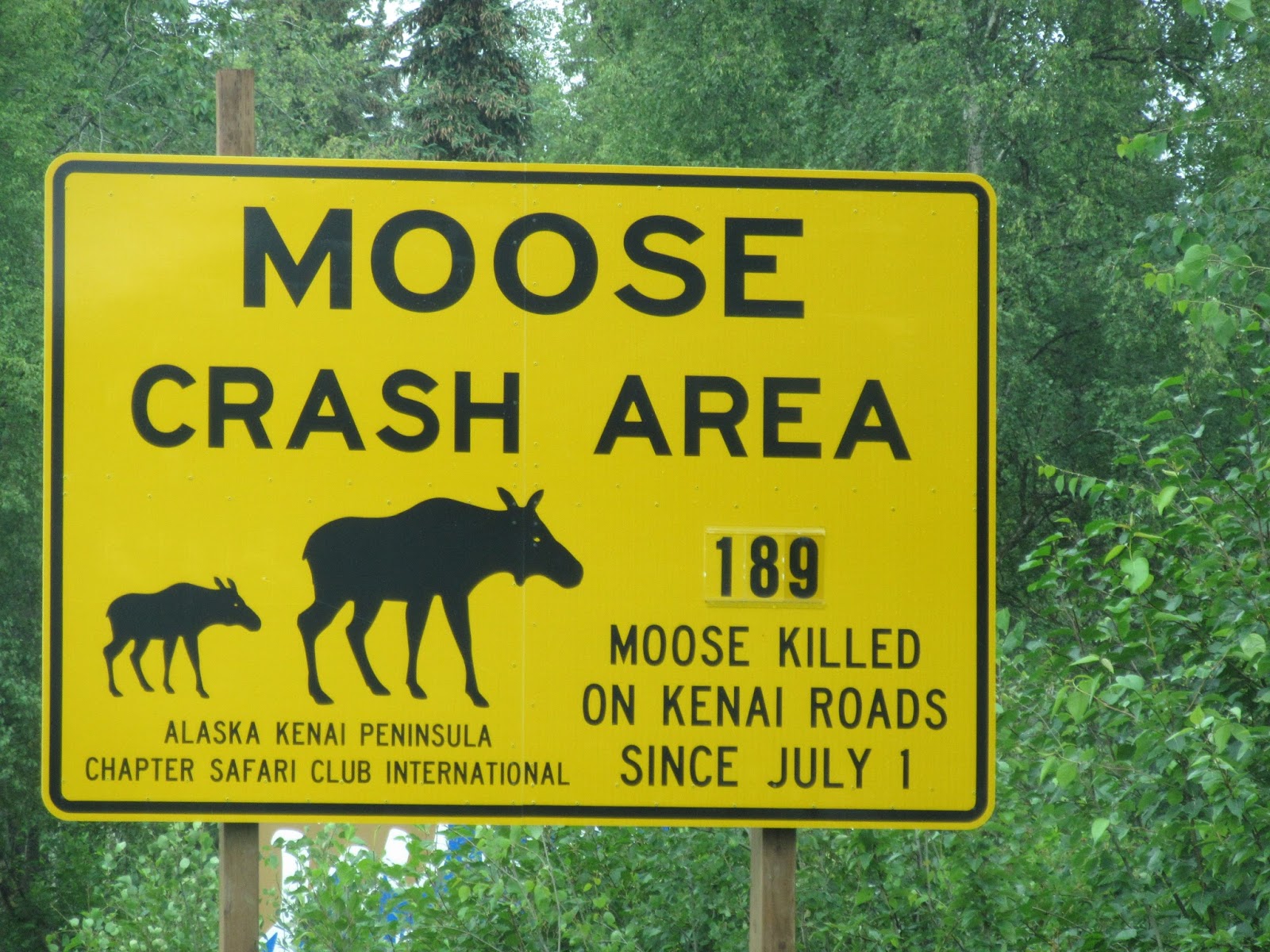
For one, we saw a moose and three bald eagles. We didn't get pics, but we did see them. And we finally got a pic of one of the many moose signs we saw along the roads. Believe it or not, this wasn't the highest number we saw!
We also drove the Anchor River Beach Road to the most westerly point on the North American continent accessible by continuous road...

Then we hit the Kalifornsky Beach road towards Kenai, the biggest city on the peninsula.
When a friend on FB saw that we were on the Kenai, she suggested a stop at The Moose Is Loose for donuts in Kenai. Since we were heading that way anyway, we stopped...

BEST DONUTS EVER! Not only were they HUGE but they were fantastic! I also got a roadkill cinnamon roll...

Drove out to Captain Cook SRA for lunch and hopes of seeing three of the major volcanoes in the Alaska Range: Mt Spurr (11,100') which erupted last in 1992, Mt Iliamna (10,016'), and Mt Redoubt (10,197') which last erupted in 2009. No such luck...


We had a Dolly Varden Nut Brown from Kassik's Brewery while in Chitina and really enjoyed it. So we had to stop in to see what else they had while in Kenai...
Our windshield wipers weren't doing a great job and with the weather not being so stellar, we stopped at the WalMart in Soldotna to pick up a new pair in case the rain got worse. And while we were there, we picked up a few souvenirs...
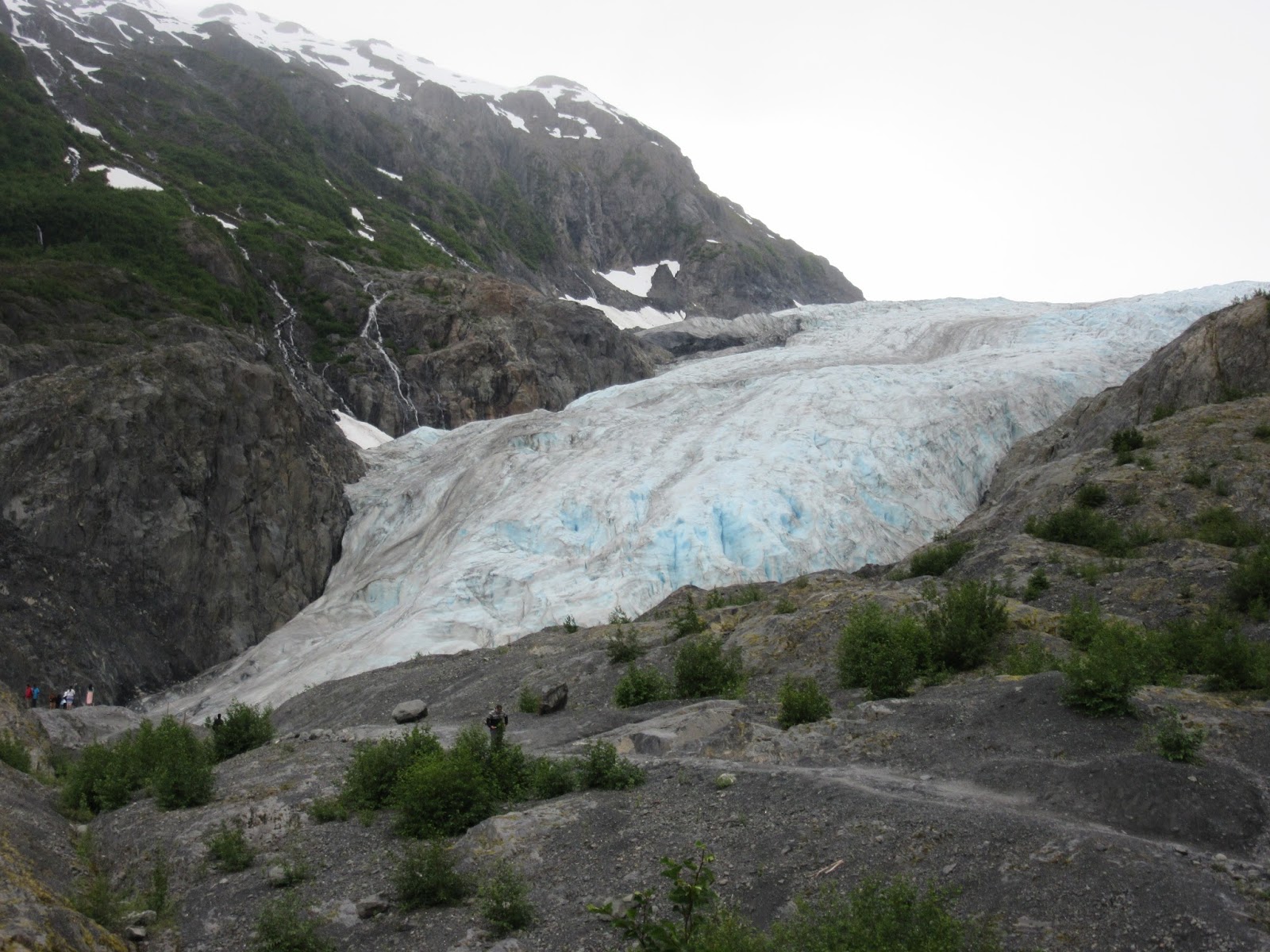
Then it was back to the Seward Highway and a stop at Exit Glacier...
When you drive along the road towards the glacier, you see a sign on the side of the road about 1.2 miles from the parking lot that reads 1815. This is where the glacier ended in 1815, you can't even see it yet. You first catch a glimpse of the ice at about the 1899 sign. There were several signs along the trail to the glacier, all marking where it was in a certain year...


2005 was the year Zack came to Alaska with Grandpa and Grandma...


They say it moves about 50 feet every year...

We hiked up as close as you can get...


Seward is named after William Seward, US Secretary of State (he was wounded the same night Lincoln was assassinated) and was instrumental in arranging the purchase of Alaska from Russia in 1867. It was also the starting point of the Iditarod Trail to carry mail to Nome over 938 miles. Resurrection Bay is an important ice-free port that was founded in 1792 on Easter Sunday by a Russian fur trader and explorer.
Even though the 4th of July hype was all over, it was still hard finding a place to camp in Seward. We didn't have much luck south of town either, but we did see a sea otter...

For the first time, we called a modest hotel away from the water. When they quoted us a price of $250 a night, we got over the shock and drove to the gigantic municipal campground in hopes they would still have space...

God is good! Not only did they have a space but it had a view of the water and free wi-fi. And it turned out to be the quietest campground we'd stayed at yet. With about 300 spaces, that's saying something...
On the downside, our late dinner at the Seward Brewing Co (the only place still open) was probably the most disappointing meals of our entire trip. :(

No comments:
Post a Comment