The second day we woke up to the promised sunshine and blue skies.
First we went back to the bridges over Deception and Canoe Passes. Deception Pass got its name from Captain George Vancouver in June of 1792. I can't imagine the weather was this gorgeous that day...
We could even see Mt Baker from the Deception Pass bridge.
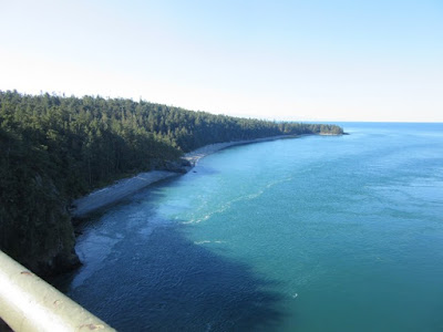
North Beach at the state Park from 180 feet above Deception Pass
There were large beds of kelp everywhere along the water's edge...
Built with over 1500 pounds of steel and giving passage to about 15,000 cars every day, we had to walk down the stairs and underneath to pass to the other side...
I wonder what the view are like from the water speeding by on currents that can reach up to 9.2 miles per hour!
Next stop was the trailheads at Bowman Bay on Fidalgo Island...
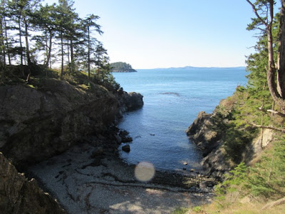
Bowman Bay from the trail to Rosario Head
Deception Island in the mouth of Bowman Bay
We walked down and explored the tide pools on Rosario Beach before walking up to the head...


Kwuh-kwal-uhl-wut, the Maiden of Deception Pass marks the path up to Rosario Head...
The view at the top of the trail was beautiful and the perfect spot to enjoy our lunch...
The hike back was just as pretty...
The madrone trees were lovely and often made for the perfect picture frames...
On the other side of the bay we walked out to both Lighthouse and Lottie Points.
We came upon the perfect swimming beach with smooth sand and clear water. Unfortunately the water was blocked by huge piles of slimy green seaweed... :(
For a while the trail wound away from the bluff and into the woods...
But it wasn't long until we were back to the views of the water...
Deception Island
This little beach was lovely and secluded, but also quite the climb down. Not to mention the climb back up...
The lighthouse at Lighthouse Point was a little anti-climatic. Just a little beacon on a post...
But we did get a different view of the bridges from a distance...
a viewpoint on the Lottie Point trail
The Deception Pass Bridge is 976 feet long and the Canoe Pass Bridge is 511 feet for a total span of 1487 feet!
I trudged down a bit of a hill through some thick brush on a "trail" to get this picture of both bridges. I'm not sure it was worth the work... :/
Cap Sante Park in Anacortes was next on our list and the GPS took us to the Rotary Park near the Cap Sante Marina.
It was a pretty little park on the water but I really wanted to get a view from the hill above.
It was a really steep walk up...
Just as we reached the top, Chris spotted a buck bedded down in a small clearing out of view...
As we got closer to the top we began to hear traffic and suspected that we could have driven up.
Yup. We were right. The actual Cap Sante Park was at the top of the hill at the end of a road. Oops...
The views from the top were worth the hike up...
But we weren't willing (ok, I wasn't) to walk the same trail back down. So we just walked down the must longer but less steep road back down to Rotary Park and the marina.
turned out the buck had a girlfriend ;)
The signs of Fall were all around us...
By this time we were ready for supper and drove to the Anacortes Brewing Company. Let's just say it was a good thing we were really hungry. We won't be going back. :/
But our waitress did recommend Washington Park for watching the sunset. Thankfully we made it just barely in time...
It was really cold and windy but we bundled up and stayed for a bit to watch the sun go down and the ferries heading for Vancouver Island. Oh, and we also watched a seal swim by...
Before going back to camp, we made one last stop at The Store in Anacortes for the best muffins ever for our breakfast the next morning. <3 nbsp="" p="">


No comments:
Post a Comment