


The scenery along the way was impressive, too...


In 1990, a Fort Nelson swim team started the tradition of leaving messages along the side of the highway using rocks. It stuck...

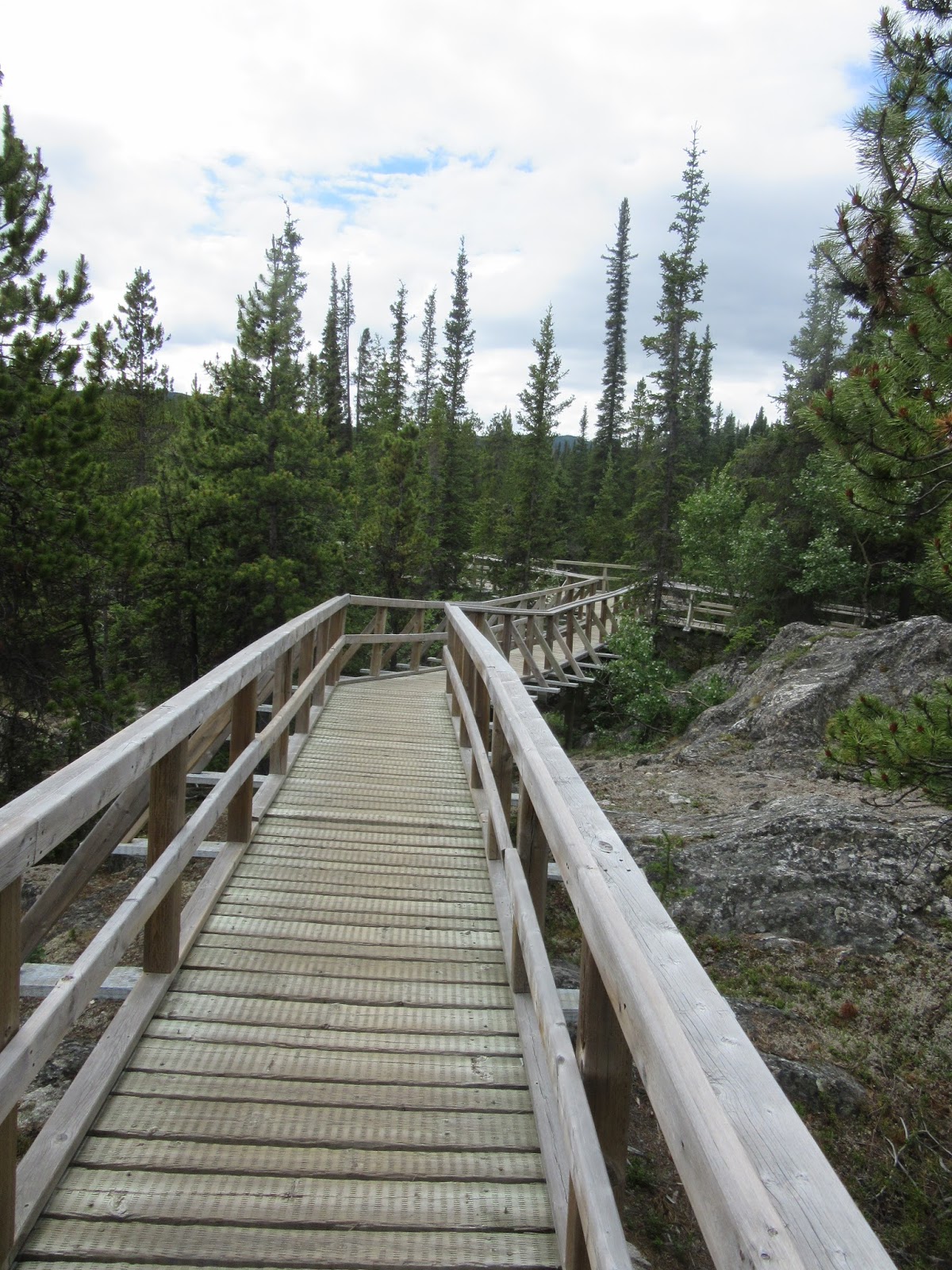
West of Watson Lake, the Alaska Highway follows along the Rancheria River. This route saved engineers hundreds of miles of highway construction. Rancheria is a Spanish term used by Mexican and California miners that means "a native village or settlement". It is also the name of a very nice trail out to two falls along the river with the same name...


Right after our hike, we crossed the Continental Divide that separates two of the largest river systems in North America: the Yukon and Mackenzie. The Yukon flows NW 2,300 miles to the Bering Sea (Pacific Ocean) while the Mackenzie flows 2,650 miles to the Beaufort Sea (Arctic Ocean).

The Teslin River bridge (or Johnson's Crossing according to locals) is the third longest water span on the Alaska Highway, spanning 1,770 feet) high above the river to allow river steamers passage from Whitehorse to Teslin until 1942.


Next up was Marsh Lake, named in 1883 after a Yale professor. Popular with Whitehorse residents, we stopped at Army Beach to dip our feet.


Except for the blue color (which you can't see so close to the shore thanks to the waves bringing up all the sand), it was a lot like wading in the Pacific Ocean in the summer... ;)
There is some debate about the source/length of the Yukon River and whether it is the 4th or 5th longest in North America. Either way, at about 2000 miles, it's pretty darn long! And the Lewes River Marsh near Whitehorse is widely considered its beginning. It drains 3/4 of Yukon and 1/3 of Alaska!


Then we finally reached the "big city" of Whitehorse. Over 2/3 of the population of Yukon Territory live in Whitehorse, its capital since 1953.
When you’re living in your van, peeing in pit toilets, and
driving on partially paved roads, you really don’t notice you really need a
shower. After all, you just had a cleansing dip in 112 degree sulfur water. The
hot springs park ranger said it was just as good as a real shower. That’s easy
for him to say when he goes home to a real shower every night. But when you approach
a real town and realize need to go to a store, it suddenly becomes painfully
obvious. You need a hot shower and you are willing to pay $100 for a RV park
with free, untimed showers.
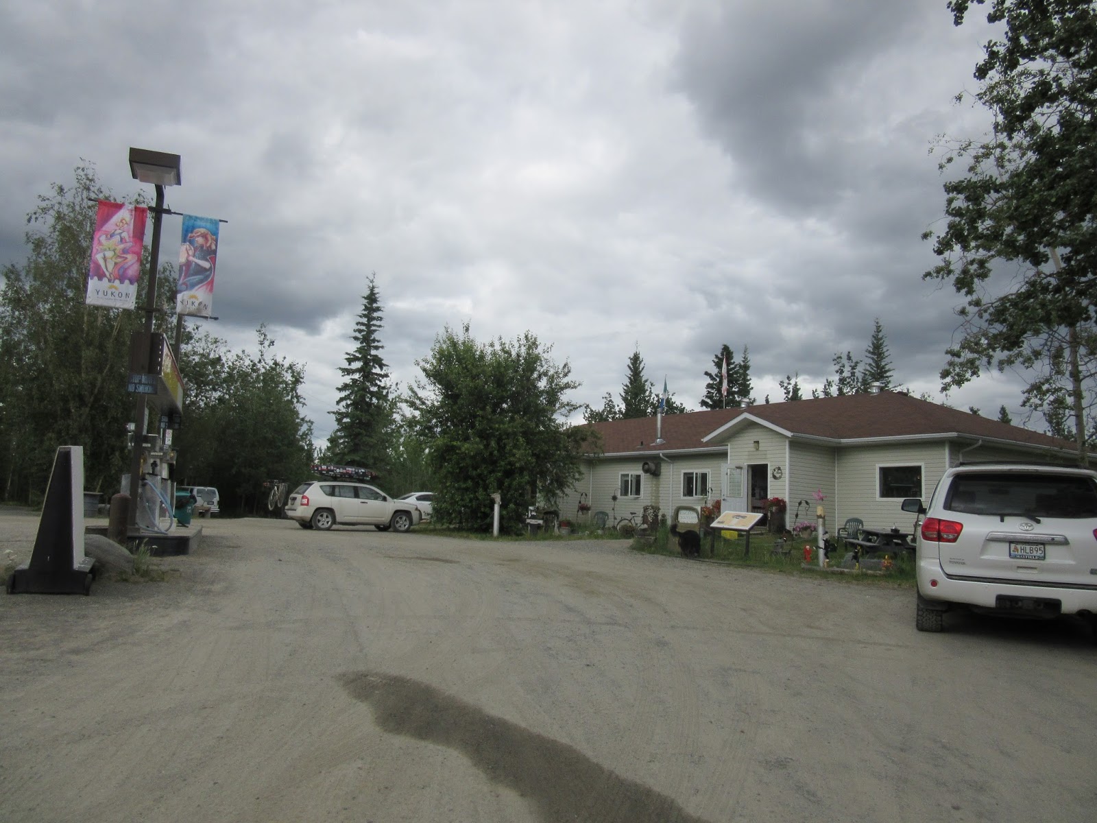
Thankfully, we got all that for the bargain price of $21 at Hi Country RV Park. One of the nicest places we stayed on our whole trip!


They also had quite the collection of WWII era vehicles...


After a long hot shower, I got dressed in my city duds and hit the town.

First was dinner at the oldest building in Whitehorse. That's where every other tourist in Whitehorse wanted to eat, too. So we wandered around downtown while we waited...


Then we made the all-important WalMart run and found where everyone who couldn't get a spot at Hi Country was staying...


1 comment:
Love hearing and seeing what/where/and who you lived with during this part of your trip. Can't wait to see day 7!
Post a Comment