
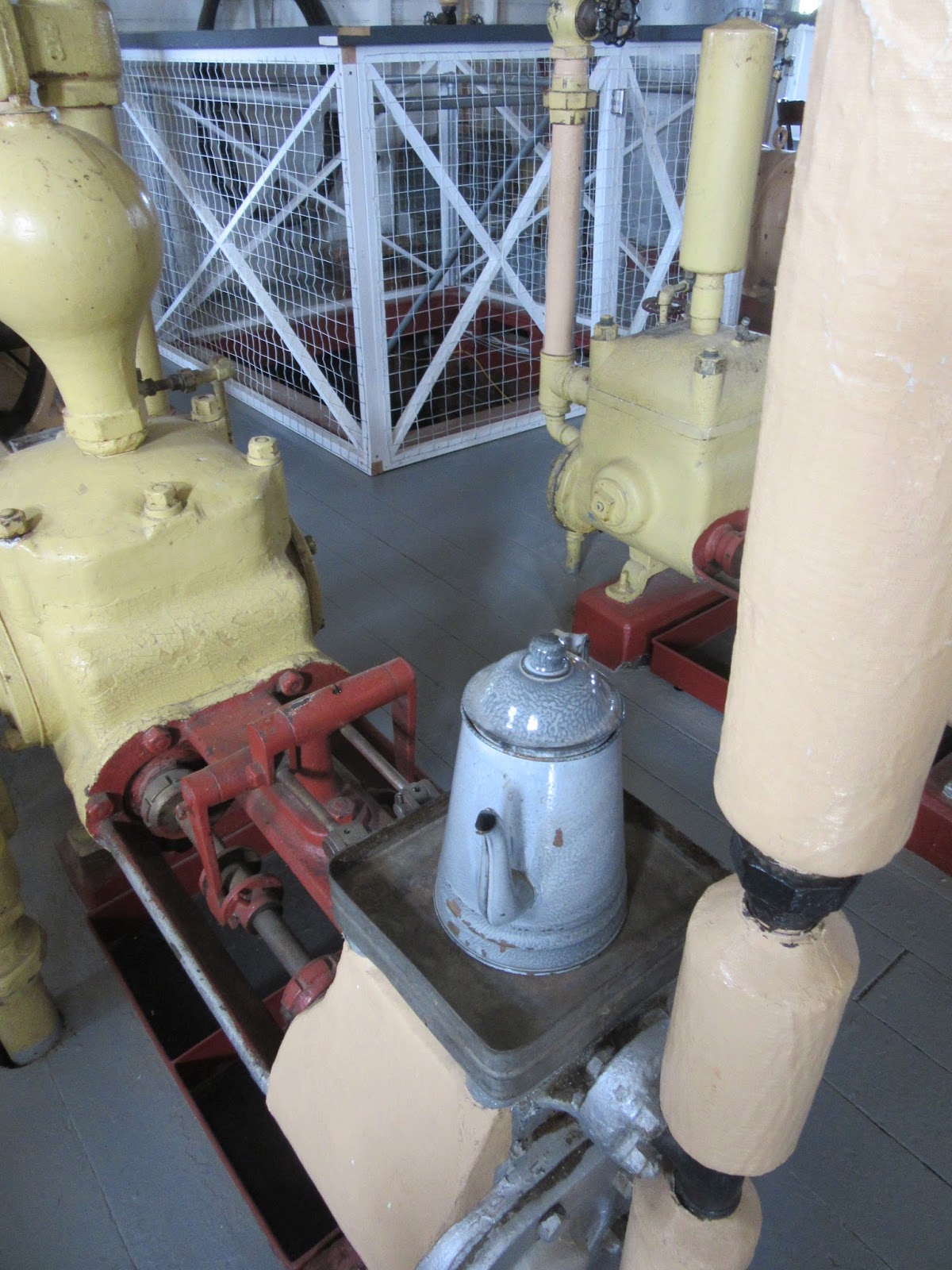
She was built in 1929 and with a capacity of 300 tons, was the largest vessel on the Yukon until she ran aground in 1936. The parts were salvaged and used to build the SS Klondike II, launched in 1937. The Klondike ran mail, passengers, supplies, and silver ore along the 460 mile route between Whitehorse and Dawson City until 1955.


Beautifully restored, it was full of some many fun things that I just had to take pictures of! It also made me sad that I wouldn't be in town to go to the high tea on board the following weekend... :(


We worshiped at Grace Community Church, a small congregation. They were a very friendly and Bible-based church. We sang songs much like at our church and heard a sermon on the Trinity from John 16:4-15.

Once on the South Klondike Hwy, our first stop was the abandoned ruins of Robinson Roadhouse. It was simply a railroad siding until gold was discovered nearby in the early 1900s and a town sprung up. Low yields caused Robinson to be abandoned by 1915, but postmaster Charlie McConnell stayed and established one of the first ranches in the Yukon.


Emerald, or Rainbow, Lake gets its brilliant colors from the light reflecting off the white marl bottom. Marl is a mixture of decomposed shell mixed with clay that is common on shallow, freshwater lakes with low oxygen levels in summer months.


Thus far we had avoided the bustling attractions frequented by bus loads of tourists, until we got to Caribou Crossing Trading Post. I suppose we couldn't avoid it forever. But 20 buses were a little much. We just used the bathroom, poked around a little, bought two donuts to snack on and moved on...


The world's smallest desert is just outside of Carcross and is a series of dunes left behind by a glacial lake. It seems strange to see so much sand so far north in Yukon Territory.


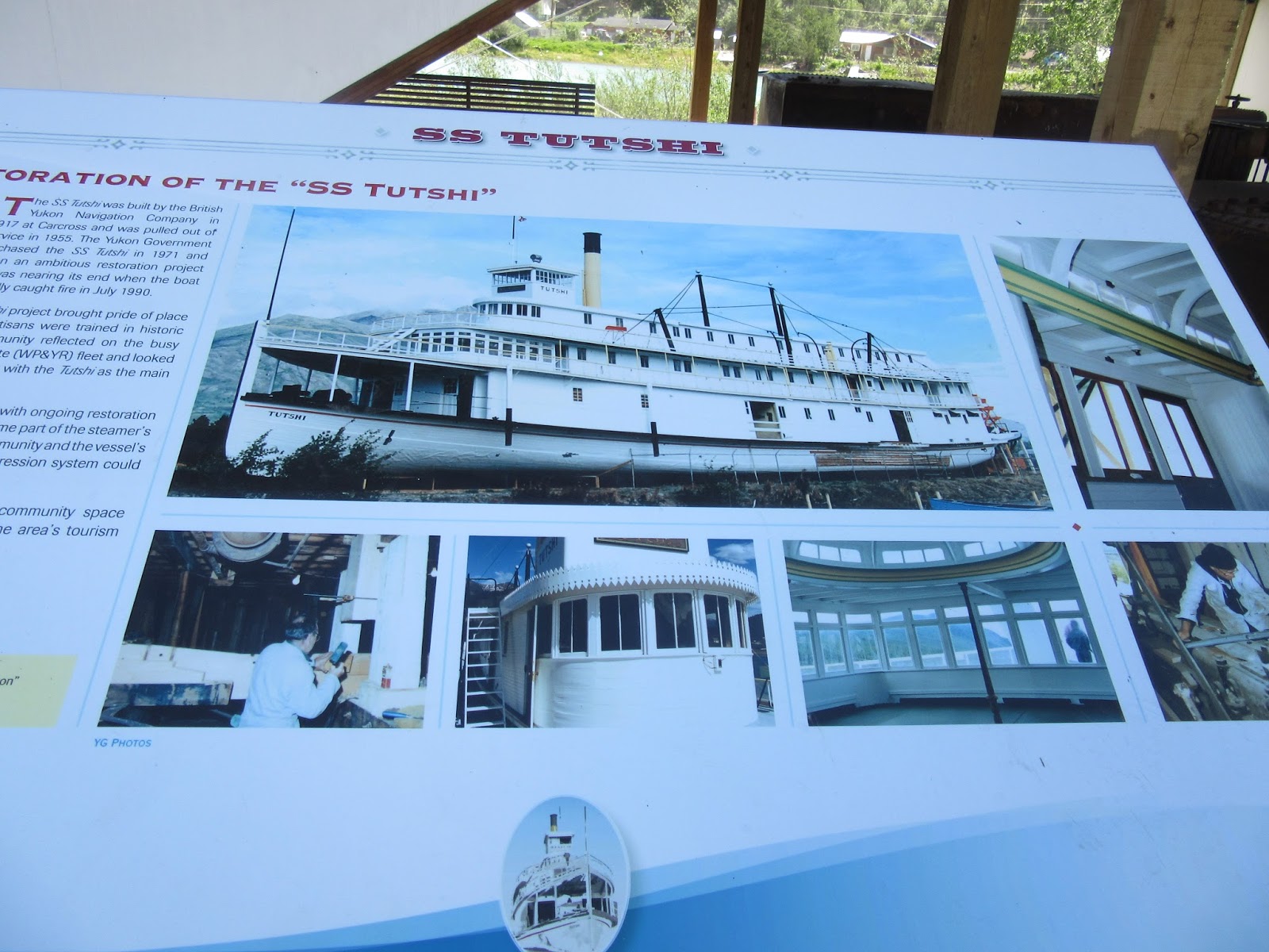
The town of Carcross is the stopping place for the White Pass & Yukon Railroad trips from Skagway and a big tourist location. The burned out remains of the SS Tutshi (too-SHY) are still there, as well as the oldest store in Carcross, and the first post office in Canada.


Then we continued along the Atlin-Tagish-Carcross Scenic Loop towards Atlin, BC. Atlin sits on the shore of Atlin Lake. Atlin means "big water" in the local indian dialect and rightfully so. It sits at 3,198 feet elevation and is 90 miles long, covering 307 square miles and is the largest natural lake in BC.


The MV Tarahne (tah-ron) was built in Atlin by the railroad in 1916 to carry passengers and freight to Scotia Bay.

Thanks to one of the richest gold strikes in the Klondike Gold Rush, Atlin sprung up along the lake in 1898.


Now about 350 people call it home.

And we met one of its most enthusiastic residents, Archie. He stopped in his truck and told us all about the virtues of living in Atlin. I think Archie tries to convince everyone he can that they should retire there. He also told us about a side trip out of town to see a waterfall and distant glacier.
Archie seemed like an honest guy, so we followed his sketchy directions to see what we could find.
True to his word, it was not a trap to waylay us foolish travelers, but was in fact a very pretty waterfall and glacier... ;)


After backtracking all the way to Carcross, we continued on south towards Skagway, AK...
Along the way we stopped at Lake Bennett...

Tagish Lake...


Tutshi Lake...


As we got nearer White Pass, the temperature started to drop to the coldest we had seen... 47 degrees.


White Pass and the Chilkoot Trail have a fascinating yet tragic history.
Thousands of gold seekers came pouring into Yukon over the 30-mile Chilkoot Trail. In order to help ensure their survival, Canadian officials required each miner to bring 1 ton of supplies into Yukon, 1000 pounds of food (1 year's worth) and another 1000 pounds of supplies. The first stop was Scales, where they weighed each miner's supplies. They then had to carry them straight up the pass, climbing over rocks in the summer or up the 1500 ice-carved stairs in the winter. It took those who persevered, about 40 trips (about 1000 miles & 3 months) to get their supplies into Canada. It is estimated that in the first year alone, between 20 and 30,000 miners made the trek! The White Pass trail was easier but not much better. Con-artists and criminals preyed on the newly arrived miners. Over 3000 horses died as they fell to their deaths, pushed on by anxious gold seekers. It soon became known as Dead Horse Trail.
After White Pass Summit, the highway starts down an 11.5 mile 11% downgrade which includes the William Moore Bridge over Moore Creek...


Then we finally arrived in Skagway, settled into the first campground we came to, and started to make dinner...

We ate dinner in the van...

No comments:
Post a Comment